Here’s something a little different from your usual bird reports…
I have taken my son Samuel up Snowdon a couple of times so, with the spring half term approaching this year, we decided it was time to launch on assault on the other peaks that make up the well-known Three Peaks Challenge, namely Scafell Pike, in the Lake District, at 978m [3209 feet] the highest “mountain” in England; and Ben Nevis (1245m) [4411 feet], the highest mountain in Scotland and the UK. It would thus be a Twin Peaks Challenge. In contrast to the genuine Three Peaks, we would not be trying to do the whole thing in 24 hours, not with just me driving.
The very worst place to begin such a challenge is Poole, Dorset, where we live. As the old Irish farmer is supposed to have said when asked the way to Dublin: “Well, you wouldn’t want to start from here”. The nearest peak is about six hours drive away. And, by the way, he could have added that you wouldn’t want to go during half term, either, making the mountains potentially busy. And the traffic is likely to be a nightmare. It was, too, although not always in the way we imagined.
Anyhow, this brief account will give you some idea of what to expect from the walks, and also I will mention some of the birds which we saw, which were quite good.
Bearing in mind that you can buy a castle in Poland for less than the price of a night in a Lake District hotel at half term, we (I) decided to stay on the nearby Cumbrian coast. And where to get a better deal than Sellafield, which at this time of the year is about the same price as a night at Chernobyl? In the event we found a hotel in the dormitory town of Cleator not far from the famous nuclear power plant, and it suited us perfectly. The Grove Court Hotel turned out to have a really excellent restaurant, much used by locals. It was clean and very friendly: a hit.
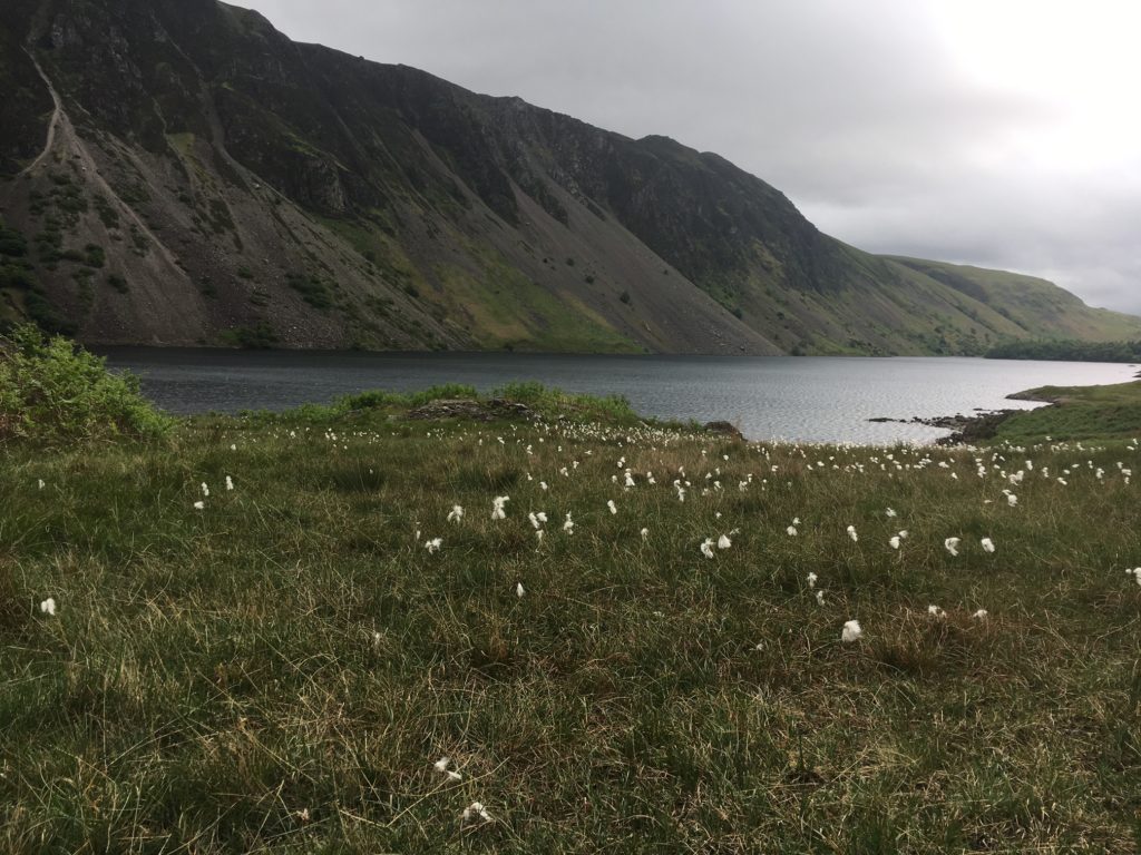
The thing about Cleator is that it is only half an hour from the heart of the Western Lake District and, happily, Wasdale Head, the gateway to the quickest climb up Scafell Pike. Although brief, the drive inland takes you past Wast Water, which is glorious. There were a couple of Mute Swans and a Red-breasted Merganser on here. Just a little on from the end of the lake, and across a narrow bridge, is the National Trust car park. What the bridge and the narrow road must be like on a hot summer’s day I don’t dare imagine. Today, in late spring, the whole place was almost deserted. This being half term I had decided to arrive early, expecting hordes of Peakers, but at 8am there were only two other cars. The car park has a National Trust shop and coffee kiosk and costs £6 a day for non-members to give you enough time for an ascent.

Wast Water
There was a friendly-looking NT lady nearby picking up litter. She had a Scottish accent, so I carefully checked the map to make sure we hadn’t driven to Ben Nevis by mistake. Rather foolishly I asked her how what the best way up Scafell Pike was, rather disastrously laying bare my lack of preparation and making me sound like the worst sort of “trainers and clueless” walker. Rolling her eyes at the idiocy of peak tourists (at least inwardly), she explained slowly that we needed to follow the left side of the beck (stream), cross over it to the right, follow up to a flat section and then go round the left side of the peak and up to avoid the dangerous direct ascent. This turned out to be a fair description of the walk, but once underway I was surprised at the lack of signposts; in fact there was just one, right at the start. Anyway, the NT lady looked us up and down and declared: “Well, at least you’ve got good boots.” This was probably a veiled insult. I certainly wasn’t about to confess that we had both recently acquired these boots and were using them for almost the first time.
As a southerner, I was delighted to hear Willow Warblers everywhere, and a Redpoll also flew over the car park. Almost from the start we enjoyed the antics of Northern Wheatears, some foraging on the path and several in song-flight, great entertainment for the longish trudge that is an ascent of England tallest pimple. There were also Grey Wagtails on the beck.
The initial climb along the left side of the stream (Lingmell Gill) is easy enough, and anyway your enthusiasm pushes you upwards without much of a thought. The views get better and better as you look back, and labelling will be easy for your photos: “Wast Water from part way up;” “Wast Water from higher;” “Wast Water from higher still” and so on. You can also see the nearby Irish Sea from here. Once you cross over there are some much more strenuous sections, including areas where the path is effectively a rock staircase (easy to go up, much harder on the feet going down). During our visit there were a large number of heavy-duty bags containing rocks left by the wayside, the latter of which will be used to reinforce the path. It’s an amazing thought that people must have carried these up here. Maybe the local Tescos stores all have their own-brand rock section, too – we must check.
After about an hour spent walking, admiring the view and faffing about with the Go-Pro, we reached the section labelled Hollow Stones. It is here that mere mortals must make sure they bear left so as to climb the peak from the north-west, eleven o’clock from the summit. This involves a very welcome section of almost flat walking, when you can also enjoy the sight of the looming peak ahead. Or at least, you can in the right weather. In our case, a slightly gloomy forecast soon proved right, and it began to assume the Lake District’s default setting, driving rain. This was probably the reason that hardly anybody was climbing this morning. We did pass by a father and nine-year-old son, the latter delightfully talkative and full of excitement at all the Lake District peaks he had climbed that week, evidently a minimum of a hundred and twenty of them, judging by the names he reeled off.
Once you negotiate your way to eleven o’clock (beyond Lingmell Coll), you reach a point where there’s a choice either to carry straight on or go up a steep path to your right. It might sound obvious (yes, it’s a mountain), but you indeed turn right here and it soon becomes a genuine upward scramble with some hard going. The path would be hard to follow but for the fact that, for this last assault on the summit, there are cairns (piles of stones) every few metres to guide you along. And today we really needed them; the rain was persistent and the cloud closed in so much that it could have obscured the walls from the centre of a living room.
The only other people scrambling along with us were a young couple who, on the basis of our experience, could conceivably be candidates for the nicest people in the universe. They were friendly and chatty on the way up and, having reached the summit slightly before us, cheered when we made it too. They offered us some home-made fruitcake as we all cowered by the summit cairn in the rain. Then, when Sam confided that he had felt some pain in his ankle, they offered him an entire packet of jelly-babies.
“Are you okay, sunshine?” the lady asked Sam. It is probably the first time he has ever been called that. But in truth the lady was describing herself and her partner, rays of sunshine on a stormy summit.
Scafell Pike was, of course, only meant to be the prelude to the serious business of Ben Nevis the day after tomorrow, so I was pretty concerned about Sam’s ankle. Nevertheless, I wasn’t about to carry him and I wasn’t about to call Mountain Rescue (the NT lady had probably already warned them), so we took ourselves slowly, taking exactly the same route down. Well, the map said it was the same route, but it certainly felt much further. I think the descent took longer than the ascent; it felt like very hard work. The rain persisted until near the end, and by the time we reached the bottom we were feeling tired and sore. It didn’t help that some people, who clearly hadn’t done the whole walk, were skipping down the path faster than us. Amateurs! I calmed myself by watching Northern Wheatears and Meadow Pipits in their flight displays.
In the evening we felt that we deserved a celebratory dinner. Finding anywhere on a bank holiday evening wasn’t easy, so we were delighted when we happened upon a Brewers’ Fayre in nearby Cockermouth. Suffice to say that our delight didn’t last long. We endured a 45 minute wait for a table (fair enough), only to be told that it was then a 30-minute wait once your food was ordered (not fair Brewers Fayre). Once the food came we might as well have eaten plastic. If you come here, make sure it is to “celebrate” a large tax bill or divorce, or both.
The day after, it took about six hours to drive to Fort William, the gateway to Britain’s highest mountain – through Glasgow, beside Loch Lomond, past the extraordinary scenery of Glencoe, where they filmed “Skyfall”. I wouldn’t normally bother to mention a drive on a blog like this, because drives are meant to be uneventful. But just as our journey finished, as we were making our very final right turn into the Croit Anna Hotel car park, an idiot in a Ute ploughed into the back of us. Visibility and weather were fine. I hadn’t braked suddenly. The young man said “I was just enjoying the scenery.” Seeing a Black Guillemot on Loch Linnhe later that afternoon described my mood perfectly.
The next day at 7.30am, with a buckled boot and an inability to lock the car, we turned into the Visitor Centre car park in Glen Nevis. This is where just about everybody takes the only recognised tourist trail up the mountain, the “Tourist Path” or “Mountain Track”. Amazingly, it only costs £3 for a whole day to park. The air was warmer and busier than in the Lake District, and the car park was already populated by climbers and midges. As in Cumbria, a Redpoll flew over and there were Willow Warblers singing everywhere, which presumably constitutes the prelude for every half term walk in Britain. The hike starts by crossing over the River Nevis on a smart new bridge. Today the Visitor Centre was closed for refurbishment and the first part of the walk altered so that you had to ascend the fields up towards the Ben Nevis Inn and Bunkhouse to find the path up. Presumably you usually take a path beside the river for a while.
The famous climb up Ben Nevis totals 17km there and back (10.7 miles) and it goes from sea level to 1345m and down again. That is a pretty long trek, but as a walk it technically isn’t difficult at all. The one thing to avoid, as we neglected to our cost, is talking to a knowledgeable Yorkshireman on the way up – more of that later.
The first part of the trail takes you up the side of the valley, through some scrubby woodland. It overlooks the river, road and large campsite. From here we could hear a Cuckoo singing in the valley, and we were fortunate that a Twite flew over us calling. There were a few Tree Pipits displaying over the tree clumps and many Willow Warblers singing; all in all a delightful atmosphere. The trail is good for flowers, too, and we saw large clumps of such delights as Common Butterwort, an insectivorous plant which traps bugs on its sticky leaves. Further up we also saw some saxifrages.
The path soon turns serious and rises in a series of hairpins. After a while you turn away from the valley tracking left (north) above a stream. We had made steady progress and about this point, flushed with success from a walking for an hour or so, we ran into the Yorkshireman.
“I think we must be about a quarter of the way there,” I was muttering.
“Oh, no,” he declared. “You’re only two-thirds of a quarter.” He went on to say that he had climbed Ben Nevis four times previously.
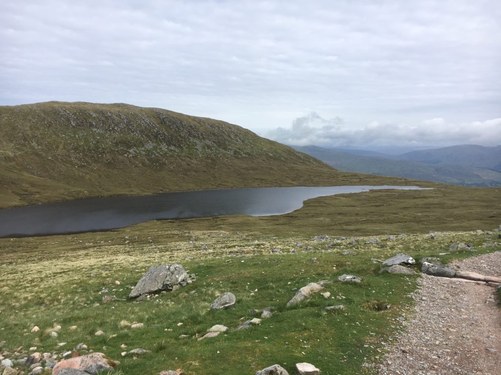
A little crestfallen, we pressed on and eventually reached Lochan Meall an t-Suidhe, a name that only trips off the tongue if you have been overdoing the drams of whisky. This lake has been nicknamed “Half-way Lochan” by generations of mean-spirited hikers who know full well that it isn’t half way, at least not from the Visitor Centre. You have a minimum of two hours of hard climbing to go from here.

The “Half-Way” Lochan
Unless, that is, you choose to run up Ben Nevis. Just above the Lochan, where the track to the summit makes a right turn, we, together with several other normal human beings, watched in amazement as a young man ran down from the main trail at considerable pace and, looking as fresh as a daisy, disappeared over the horizon. They say that running is good for your health, but at this point at least six of us, breathing hard from our sedate exertions, all felt like strangling him. (If you ever do Parkrun, the 5km fun-run that takes place on Saturday mornings all over Britain, you will know about being lapped by annoyingly fit human beings; my particular bugbear is being passed by a young parent pushing a buggy of twins, serenely leaving you in their wake at kilometre four.) Anyway, the truth is that everyone takes Ben Nevis at their own pace, and you will inevitably meet people who make you feel inadequate. In truth, I salute these people and wonder where my youth went.
My youth Samuel and I now faced a new section of long, hard hairpins, the beginning of the slog up towards the summit. You pass a waterfall, which is delightful, and then it is rocky path, sweat and effort. Each zig and zag seems relentless, and there are some rough sections where you have to take big, heaving steps.
“There’s a long way to go yet,” said the Yorkshireman as we passed at one point, sapping our energy like a Dementor (in the Harry Potter novels.)
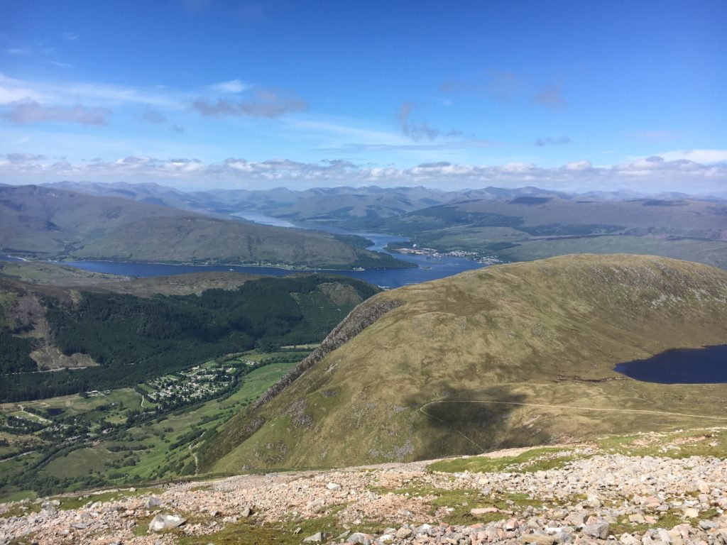
It might not have been sunny in Yorkshire, but now, in mid-morning, it shone on Britain’s highest peak. It was still and clear, too, which really isn’t supposed to happen. The locals will tell you that it rains for 370 days of the year in these parts. Even the girl at Cotswold, who sold us our boots, shrugged and said “It’s never pleasant up there” as the till rang. But now we could see Fort William far below, Loch Linnhe and Loch Eil and indeed, much of the Western Highlands. One wag has said that you know you’ve reached the top of Ben Nevis when everything else is below you, and today it really felt like it.

Looking down the Glen Nevis Valley towards Loch Linnhe (mid-left) and Loch Eil (branching away to the left)
It wasn’t a lonely experience, though. By now the mountain was being swamped by swarms of hikers. As early-birds, we were mainly looking down upon the, on the bottom zigzag in lines, like colourful ants. The crowds made us want to press on, and soon we realised we had reached the top of the hairpins.
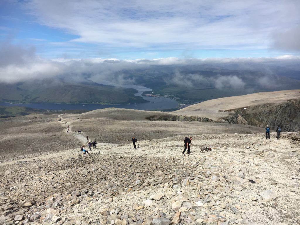
I was under the impression that it wasn’t far from here to the summit plateau. The landscape certainly changed dramatically, with a moonscape of shattered rocks. We encountered our first snowfield of the trip and began to feel excited.

The “moonscape” plateau near the summit of Ben Nevis
“That’s the cairn marking three-quarters of the way up,” said the increasingly unwelcome voice. “You’ll be there by midday, hopefully.”
Sam and I looked at each other, dismayed. It was just after 11am. By now we were both worn out. People do warn you that it is basically a very long walk up Ben Nevis, but this was harder than we expected.
But our correspondent either had a defective memory or a defective sense of humour. Within ten minutes the landscape opened out and we could see the mishmash of cairns and buildings that marks the summit. It comes quite quickly and surprisingly, so much so that we didn’t really have time for an adrenaline rush. It was a case of: “Oh, here we are, then.” We self-consciously took a couple of pictures of ourselves and settled down for lunch, admiring the view and watching people’s various reactions to reaching this lofty point; some ecstatic, some quieter, most joyous, everybody deeply satisfied.
As we ate, we were sent a treat. A fabulous male Snow Bunting flew to the top of the ruined observatory, sang a few phrases and disappeared: crystal clear voice, crystal clear plumage.
It is hard to admit this, but almost as great a thrill as reaching the top of Ben Nevis is the experience of coming down from the summit. The thing is that on your way down, everybody you pass by knows that you have made the summit, and they hold you in a sort of temporary high regard. Whether or not you want to, you feel insufferably smug. People keep asking you how far they have to go (a less attractive answer each step you descend, of course) or even whether you think they can make it. On this day our descent coincided with the rush of summit-seeking humanity.
“I must have said hello to about a hundred people already,” confided an alarmingly svelte lady as she overtook us ten minutes down from the summit, echoing my thoughts. Her auburn hair was as long as her shorts were short and I’m not sure if her greeting was helping or hindering my fellow middle-aged males. But the upward flow of people was relentless, and made everyone’s return journey painfully slow.
We ticked off the end of the zigzags and the half-way lochan. It was now decidedly warm. Any cloud had burned off and the sun’s rays were quite uncomfortable. Several people, probably doing a Three Peaks Challenge, were trying to complete a run and looked to be struggling.
Towards the end of the walk there were butterflies everywhere, some of which were Pearl-bordered Fritillaries (or Small P-b, I’m not sure).
I needn’t describe to you the wonderful feeling of skipping back over the bridge and nestling in the car, resting our weary limbs, because every hiker knows it well. Even better was my first post-summit coffee, a rich latte at the Glen Nevis Restaurant and Bar. This establishment is just south of the Visitor Centre and looked the perfect fit for a celebratory meal. So we booked a table.
And it delivered. The service was great, the food was great, the views were great. And it wasn’t expensive at all.
The Twin Peaks were conquered.

Great story, Dominic, and a wonderful memory with your son. I remember being somewhat disappointed with Ben Nevis bird-wise, but it’s a scenic and enjoyable walk nonetheless.
Thanks, Ed.